


SLATER Voting District, Platte County, Wyoming
About
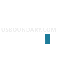
Outline

Summary
| Unique Area Identifier | 698831 |
| Name | SLATER Voting District |
| County | Platte County |
| State | Wyoming |
| Area (square miles) | 133.94 |
| Land Area (square miles) | 133.93 |
| Water Area (square miles) | 0.01 |
| % of Land Area | 99.99 |
| % of Water Area | 0.01 |
| Latitude of the Internal Point | 41.89682620 |
| Longtitude of the Internal Point | -104.77946900 |
Maps

Graphs
Select a template below for downloading or customizing gragh for SLATER Voting District, Platte County, Wyoming


Neighbors
Neighoring Voting District (by Name) Neighboring Voting District on the Map
- CHUGWATER Voting District, Platte County, WY
- IOWA CENTER Voting District, Goshen County, WY
- ROCKLAKE Voting District, Platte County, WY
- VETERAN Voting District, Goshen County, WY
- WHEATLAND RURAL Voting District, Platte County, WY
- YODER OUTSIDE Voting District, Goshen County, WY
Top 10 Neighboring County Subdivision (by Population) Neighboring County Subdivision on the Map
- Wheatland CCD, Platte County, WY (6,053)
- Goshen Hole CCD, Goshen County, WY (1,420)
- Chugwater CCD, Platte County, WY (522)
Top 10 Neighboring Place (by Population) Neighboring Place on the Map
Top 10 Neighboring Unified School District (by Population) Neighboring Unified School District on the Map
Top 10 Neighboring State Legislative District Lower Chamber (by Population) Neighboring State Legislative District Lower Chamber on the Map
- State House District 3, WY (8,892)
- State House District 4, WY (8,539)
- State House District 5, WY (7,791)